Maps
Maps are cool.
Maps are important.
There are many kinds maps.
Maps mainly tell us what is going on in a certain place.
Pain-maps help us tell a doctor where it hurts.
Anantomy-maps tells us what body parts we have and where we can find them.
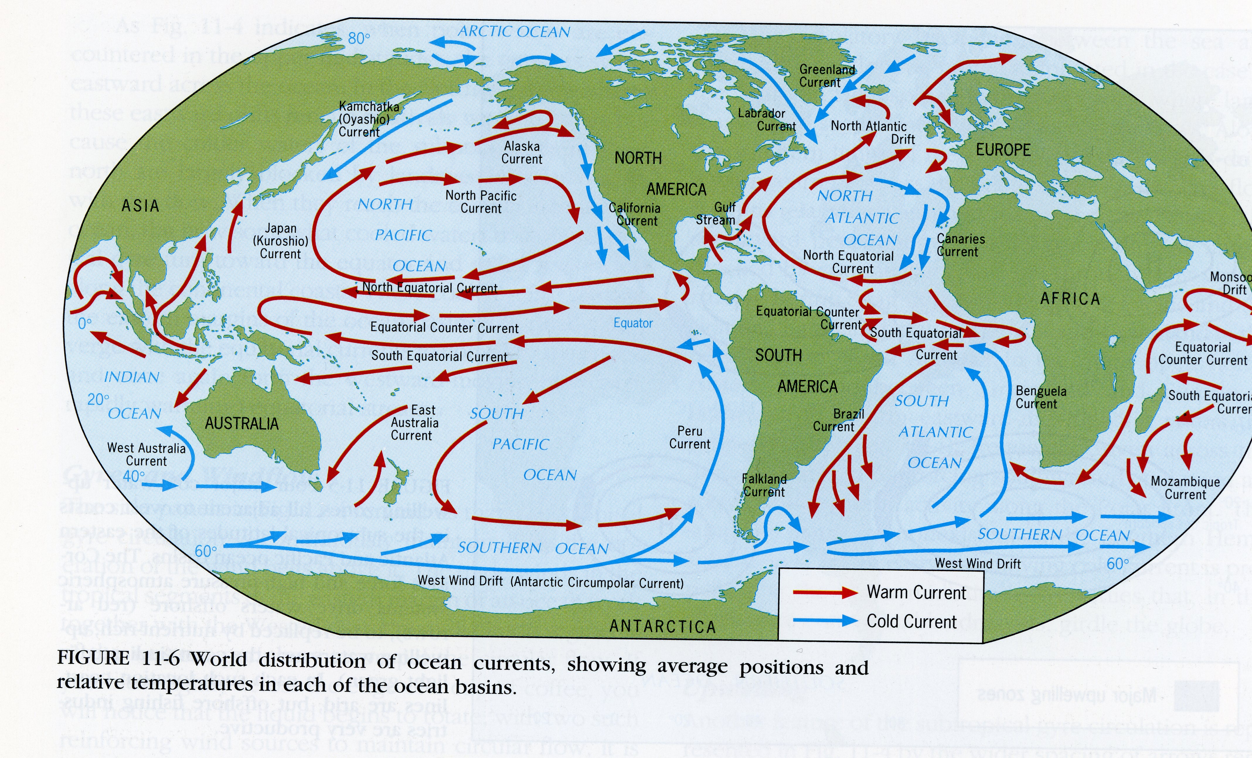
The map above tells us where the continents are, and shows water currents called 'gyres'.
This is an important part of this section, and you will learn a lot from it.
The red lines show warmer air that have absorbed a lot of warm water from the ocean near the equator.
They are the ones that give rain and snow.
They are the ones that give rain and snow.
The blue lines contains a lot less moisture, and the nearby land is dryer, even desert areas.
The location of the continents from the equator controls much of the environment.
The distance between continents determine much of the environment.
Eric J. Rose
middlegrademysteries.com
photo: oceanservice.noaa.gov